Place · region
Dawro Zone
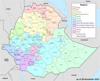
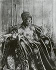
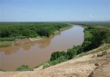
The Dawro Zone is an administrative zone of south-western Ethiopia, between the Omo and Gojeb rivers, with its centre at Tarcha. It takes its name from the Dawro people and their former kingdom, conquered by Menelik II in 1891, and it contains the Halala Kella, a long defensive stone wall attributed to the kingdom's rulers.
Mentioned in 1 state history
See also
Cite this entry
- APA
- The Epoch Institute. (2026). Dawro Zone. In The Epoch Institute Encyclopedia. https://the-epoch-institute.org/encyclopedia/dawro-zone
- MLA
- “Dawro Zone.” The Epoch Institute Encyclopedia, The Epoch Institute, 2026, https://the-epoch-institute.org/encyclopedia/dawro-zone. Accessed .
- Chicago
- The Epoch Institute. “Dawro Zone.” The Epoch Institute Encyclopedia. 2026. https://the-epoch-institute.org/encyclopedia/dawro-zone.
- Harvard
- The Epoch Institute (2026) ‘Dawro Zone’, The Epoch Institute Encyclopedia. Available at: https://the-epoch-institute.org/encyclopedia/dawro-zone (Accessed: ).
Last reviewed October 2026Random entry ↻