South & Southeast Asia
Pyu city-states
At a glance
- Twelve walled cities have been excavated, five of them large: Beikthano, Maingmaw, Binnaka, Halin and Sri Ksetra, the last more than 13 km round and larger than Pagan or Mandalay; three have been World Heritage Sites since 2014.
- The Pyu were the first in Southeast Asia to adapt Brahmic script to a tonal language, and their calendar, begun at Sri Ksetra on 22 March 638, became the Burmese calendar still used in Myanmar.
- Nanzhao's raids from 754 culminated in 832, when its warriors overran the Pyu country and carried off 3,000 prisoners from Halin; the Burmans then took over the Pyu realm, and by the 13th century the Pyu had become Burmans.
Rise & Fall
- c. 2nd century BCETibeto-Burman-speaking Pyu enter the Irrawaddy valley from Yunnan by the Taping and Shweli rivers and settle the plains around the Irrawaddy–Chindwin confluence.
- 70 CEHalin's wooden city gates, its earliest dated artefacts, are made; the city in the Mu valley grows into the largest Pyu centre.
- 80 CEThe Pyu adopt the Sakra Era, two years after it came into use in India.
- 638On 22 March the Vikrama dynasty at Sri Ksetra launches a new calendar, which later becomes the Burmese calendar.
- 739On 25 March King Duttabaung founds Sri Ksetra's second dynasty.
- 801Sri Ksetra's embassy, with 35 musicians singing in Sanskrit, reaches the Tang court.
- 832Nanzhao warriors overrun the Pyu country and take 3,000 prisoners from Halin.
- c. 1020The main walls of Pagan are built; the Burmans have taken over the Pyu realm and found the Pagan Empire in the mid-11th century.
Foundation
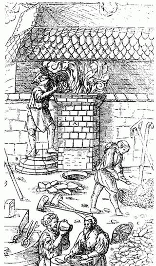
By 1500 BCE people in the dry zone near the Irrawaddy worked bronze, grew rice and kept chickens and pigs, and by 500 BCE iron-working settlements in the Samon valley south of Mandalay traded with China. In about the 2nd century BCE the Tibeto-Burman-speaking Pyu entered the Irrawaddy valley from present-day Yunnan by the Taping and Shweli rivers and founded settlements across the plains around the confluence of the Irrawaddy and Chindwin. Their realm was longer than it was wide, from Sri Ksetra in the south to Halin in the north, and the Tang records count 18 Pyu states, nine of them walled cities, covering 298 districts.
The cities rose in the three great irrigated regions of Upper Burma: the Mu valley, the Kyaukse plains and the Minbu region. Beikthano, named after Vishnu and situated near Taungdwingyi, is the oldest urban site yet excavated, its remains dated 200 BCE to 100 CE, a rectangular fortress of 3 by 1 kilometres enclosing about 300 hectares behind walls six metres thick, perhaps the first capital of a culturally and even politically uniform state in Burma. Halin's wooden gates are dated to 70 CE, and the city grew to 664 hectares, twice Beikthano's size; Maingmaw and Binnaka on the Kyaukse plains, with their identical silver coins and funerary urns, may be its contemporaries. The Burmese chronicles make Tagaung, a small Pyu site north of Mandalay, the home of the first Burmese kingdom.
Socioeconomy
The Pyu economy rested on agriculture and trade. Every important settlement lay in one of the three irrigated regions, where the Pyu grew rice, perhaps of the japonica variety, and built the dams, canals and weirs whose techniques passed to Pagan; King Anawrahta would turn the same three regions into the rice granaries of Upper Burma in the 1050s. The population of the realm was probably a few hundred thousand, and the size of the cities, 660 to 1,400 hectares against Pagan's 140, suggests that most people lived within the walls.
Two trade routes crossed the realm. An overland road between China and India ran across northern Burma from at least 128 BCE, and Roman embassies to China passed along it in 97 and 120 CE; but most trade went by sea through the southern states, which then lay near the coast because the Irrawaddy delta had not yet formed, so that ships from the Indian Ocean could sail up to Prome. Goods from 2nd-century northwest India, Java and the Philippines have been found at Beikthano, and Pyu objects along the Arakan coast, on the upper Tenasserim coast and as far east as Óc Eo. The Pyu minted silver coins from the 5th century, the earliest showing a conch and a srivatsa and often pierced to serve as amulets; they were the model for most first-millennium coinage of mainland Southeast Asia, and after they ceased in the late 9th century no coins were struck in Burma until the 19th.
Military
The Pyu built for defence. Beikthano's walls were six metres thick; Halin, rectangular with curved corners, had brick walls 3.2 by 1.6 km, four main gates at the cardinal points and twelve in all, and a moat on every side but the south, where dammed land made reservoirs. Sri Ksetra's circular brick walls stood 4.5 metres high with twelve gates guarded by huge devas, and the rice fields filling its northern half meant that with its moats and walls the city could withstand a long siege. Yet the Tang records describe the Pyu as a humane and peaceful people to whom war was virtually unknown. The chronicles tell of alliances between states, such as Beikthano with Sri Ksetra.
The end came from the north. Burman "swift horsemen" of the Nanzhao Kingdom entered the upper Irrawaddy valley in raids that the Tang chronicles date from 754 or 760; by 763 the Nanzhao king Ko-lo-feng had conquered the upper valley, and the raids intensified in 800–802 and 808–809. In 832, by the Chinese account, Nanzhao warriors overran the Pyu country and carried off 3,000 prisoners from Halin, and in 835 they raided Mi-ch'en. The Pyu did not vanish with those 3,000: no site shows a violent overthrow, and radiocarbon dating puts human activity at Halin until about 870. The raids weakened the states and let the Burmans move in; the chronicles date the founding of fortified Pagan to 849, but its oldest dated walls belong to 980 and its main walls to about 1020.
Governance & Law
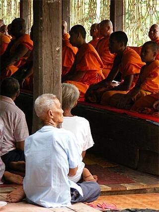
The Pyu settlements were ruled by independent chiefs. At the larger cities the chiefs later styled themselves kings and set up courts modelled on Indian, Hindu, concepts of monarchy, though divine kingship was not fully adopted, because Theravada Buddhism stood in its way. Whether the great cities held the smaller towns as vassals is unclear; by and large each city-state seems to have controlled only itself. The kings of Sri Ksetra titled themselves Varmans and Varma, and the city had at least two dynasties, perhaps three: the Vikrama dynasty, believed to have launched the Pyu calendar on 22 March 638, and a second founded by King Duttabaung on 25 March 739.
Indian culture was strongest in the south, where the sea trade came in: Sri Ksetra, "Field of Fortune", and Beikthano, Vishnu, bear Pali or Sanskrit names, and Sanskrit and Pali served as court languages beside Pyu, so that the 35 musicians of the embassy of 800–802 sang in Sanskrit before the Tang court. City plans joined indigenous circles with Indian squares and twelve gates, and Sri Ksetra's palace site of 518 by 343 metres symbolised both a mandala and a zata, a horoscope. Religion was Theravada Buddhism, probably from the Andhra region, with Tantric and Mahayana Buddhism and Hinduism widely present and pre-Buddhist cattle sacrifice, drinking and a prominence of nuns persisting beside them.
Global & Regional Impact
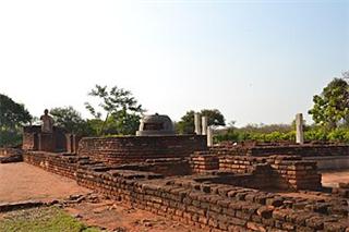
The thousand-year Pyu millennium linked Burma's Bronze Age to the classical states, and much of what Pagan became it owed to the Pyu. The Pyu script, based on Brahmi, may be the source of the Burmese script, and the Pyu were the first people in Southeast Asia to adapt Brahmic writing to a tonal language, inventing tonal markers. The calendar begun at Sri Ksetra in 638 became the Burmese calendar still in use in Myanmar. Halin's plan of twelve gates and cardinal entrances shaped Pagan and 19th-century Mandalay, Danyawaddy and Wethali in Arakan, and the Siamese city of Sukhothai a millennium later.
Pyu religious architecture was the prototype of Burma's. Its stupas and monasteries, in style, ground plan, brick size and technique, point to Amaravati and Nagarjunakonda in the Andhra region; by perhaps the 7th century the tall cylindrical stupas Bawbawgyi, Payagyi and Payama stood at Sri Ksetra. The Bebe and Lemyethna temples there were the models for Pagan's hollow gu temples, the solid stupas for the Shwezigon, Shwehsandaw and Mingalazedi and ultimately the Shwedagon in Yangon, and the 13th-century Somingyi Monastery at Pagan repeats the plan of a 4th-century monastery at Beikthano. The Burman kings of Pagan claimed descent from the kings of Sri Ksetra and Tagaung back to 850 BCE, a claim most scholars dismiss, and the histories and legends of the Pyu became those of the Burmans.
Decline & Fall
The millennium-old civilisation came down in the 9th century under repeated invasion from Nanzhao. Raids began in 754 or 760, Ko-lo-feng held the upper Irrawaddy by 763, and after the attacks of 800–802 and 808–809 the Nanzhao warriors overran the Pyu country in 832 and took 3,000 prisoners from Halin. The destruction was not total: the size of the realm and its many walled cities point to a population many times 3,000, no firm sign of violent overthrow has been found at any site, and people were still active at Halin about 870. More likely the raids so weakened the states that the Burmans could move into Pyu territory, gradually; modern scholarship holds that Burmans did not arrive in large numbers until the mid-to-late 9th century or even the 10th.
The Bamar set up a garrison town at Bagan at the confluence of the Irrawaddy and Chindwin; by the late 10th century they had taken over the leadership of the Pyu realm, and in the middle of the 11th century they founded the Pagan Empire, unifying the Irrawaddy valley and its periphery for the first time. Pyu settlements remained in Upper Burma for three centuries more, gradually absorbed into the expanding kingdom; Pyu artefacts occur across Pagan's settlements until about 1100. The Pyu language was still spoken in the late 12th century, but by the 13th the Pyu had assumed the Burman ethnicity and disappeared into history, their histories and legends incorporated into those of the Bamar.
The Pyu city-states were the walled Tibeto-Burman cities of Upper Burma's irrigated plains, from Beikthano to Sri Ksetra, which from about the 2nd century BCE traded between India and China, adopted Theravada Buddhism, Brahmic writing and the calendar Burma still uses, and were weakened by Nanzhao's raids of 754–832 and absorbed by the Burmans of Pagan by the mid-11th century.
Test yourself
5 questions on this page, from its key events and facts.
The questions open here once the page has loaded.
References
- Michael Aung-Thwin, The Mists of Rāmañña: The Legend that was Lower Burma (University of Hawai'i Press, 2005)
- G. E. Harvey, History of Burma: From the Earliest Times to 10 March 1824 (Frank Cass & Co., 1925)
- Victor B. Lieberman, Strange Parallels: Southeast Asia in Global Context, c. 800–1830, volume 1 (Cambridge University Press, 2003)
- Elizabeth H. Moore, Early Landscapes of Myanmar (River Books, 2007)
- Janice Stargardt, The Ancient Pyu of Burma: Early Pyu Cities in a Man-made Landscape (PACSEA, 1990)
- Thant Myint-U, The River of Lost Footsteps: Histories of Burma (Farrar, Straus and Giroux, 2006)
Connections
Open the full connections map →